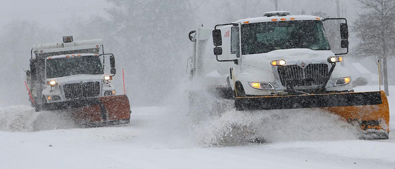
| Meteorologists have spent countless hours covering the winter storms that impacted Virginia during the last two weekends of January. But dramatic and frequent swings in the forecasts for both systems left many locals feeling frustrated and perplexed.
While the Historic Triangle endured sleet and freezing rain during the Jan. 25 storm as projected, most of Hampton Roads and Central Virginia saw snow totals that were much lower than what the National Weather Service (NWS) in Wakefield and other forecasters had called for.
As weather alerts stressed that major impacts were likely across the entire region, shoppers piled into stores, clearing shelves of emergency supplies, snow gear, bread and milk.
Those living in the Southside saw particularly extreme forecast fluctuations that continued even as the winter weather began moving in. Early reports highlighted models that showed a foot or more of snow for the Virginia Beach area, but maps released shortly before the storm dropped the totals to negligible amounts.
Williamsburg-area residents encountered icy conditions that affected travel and closed schools for a week, but many areas further south experienced only light wintry precipitation. The Greater Richmond region was similarly left with substantially less snow than expected.
Forecast challenges continued during second storm
This weekend's winter storm felt like déjà vu for many.
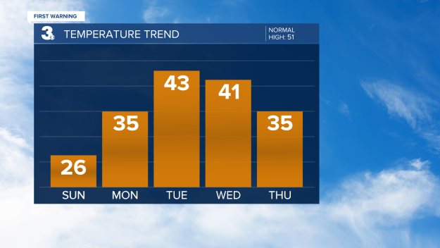
Meteorologists were more cautious about providing early snow total forecasts this time around. Still, the predicted amounts fluctuated dramatically during the 72 hours leading up to the storm, ranging from anywhere between 0 to 8 or more inches for the Peninsula.
A winter storm warning covering the Historic Triangle was issued, upgraded and downgraded multiple times, and then ultimately canceled and replaced with a winter weather advisory.
Once again, snow lovers throughout the region expressed dismay over the rollercoaster forecasts that were updated repeatedly with markedly different totals.
On Friday night, forecasters started warning viewers that the models had again shifted to include much less snow, and the entire event might be a "bust."
As of 7 a.m. on Sunday morning, the high predicted totals for the Tidewater area had not materialized, but neither did the warnings of nonexistent snow. Local news stations reported totals of two to three inches in Norfolk, down from the 6 to 8 inches many had forecasted 24 hours earlier.
Inconsistencies spur concerns about trust
The wild shifts in predictions caused some local weather-watchers to question the reliability of official forecasts.
"How can we make it so that such a huge fail doesn't happen again?" one social media user asked NWS Wakefield on Facebook. "What can we learn from this event in order to better predict next time so that people aren't wasting time and money preparing for a snowstorm that never comes?"
Several users prodded the Weather Service to launch an investigation into why the models changed so much during the last two storms.
"Weather forecasts were more accurate 15 years ago," one person said.
"You're chipping away at any trust you have, and warnings will go ignored the one time you actually get it right," said another.
So, what happened?
It depends on who you ask.
The climate systems in Hampton Roads and Central Virginia are some of the most complex in the nation. Forecasters often emphasize that the region can experience a wide range of weather patterns, making it difficult to predict how winter storms will play out.
Most local meteorologists agree that a large amount of dry air ultimately consumed the snow as it moved through Virginia during the latest storm, driving totals down. Some shrugged off the inconsistencies, pointing out that weather can be volatile.
"The atmosphere has been incredibly complex lately, which is causing those models to shift, in some cases wildly," NWS Wakefield said in a Jan. 31 comment on Facebook. "We're currently analyzing all those moving pieces to give you the most consistent forecast possible."
WAVY News Chief Meteorologist Jeff Edmondson underscored that forecast fluctuations can happen at any time of the year.
"Forecasts change. You have to watch every day," Edmondson said. "It's the same if it's snow, rain, or when we are tracking a change in wind direction for a beach day."
Some blame weather apps, social media hype
Nonetheless, social media weather pages have been overwhelmed with allegations that inaccuracies have been more extreme than usual this year.
Several weather experts are blaming AI-powered weather apps - which the public has increasingly relied upon - for adding to the confusion.
"[Many apps] oversimplify uncertainty and present highly precise-looking numbers that imply more confidence than actually exists," Northern Illinois University meteorology professor Victor Gensini told the Associated Press.
The apps often rely only on raw computer modeling data with no human oversight, which can lead to misleading numbers and graphics.
Other meteorologists said social media hype from unreliable sources led to unrealistic expectations among the public during the last two winter weather events.
"People get their hopes up. [W]hen we come in and inform people that it isn't going to happen, or it will be a lot less, we're met with skepticism and criticism... because you believed those other pages." Meteorologist Matt DiNardo of WRIC in Richmond said in a Facebook post.
National Weather Service cuts also raise questions
Last year's National Weather Service cuts have fallen under increased scrutiny in recent days, with some experts suggesting that gaps in data collection may have caused more inaccuracies in local storm forecasts.
According to PolitiFact, about 600 NWS employees left the agency in 2025 amid a combination of layoffs, buyouts and retirements.
The agency later received approval to hire 450 new meteorologists, hydrologists and technicians, Forbes reports. A proposed 2026 Trump administration budget would increase the NWS budget by about 6.7%.
Meteorologist David Tolleris, founder of WXRisk, said he was becoming increasingly concerned about the impacts of operational cutbacks at East Coast NWS stations.
"The inconsistency in the models here is just staggering," Tolleris said in a video uploaded on Jan. 31.
According to Tolleris, "part of the problem" may be that NWS has closed down multiple weather observation stations. As a result, weather balloon networks are not functioning at capacity, leading to incomplete data on atmospheric conditions.
"That data gets put into the computer models," Tolleris said. "If a network is shut down, altered or damaged, the amount of information going into the computer models cannot possibly be as accurate. That may be what we're looking at here."
Looking forward
As winter's grip begins to fade in the coming weeks, meteorologists will be left with large amounts of information to analyze while figuring out how accuracy could be improved for future forecasts.
The Triangle reached out to NWS Wakefield for comment but had not received a response by publishing time.
Meanwhile, DiNardo told The Triangle that staffing deficits at NWS have persisted, especially because not all reopened positions have been filled.
Nonetheless, DiNardo believes the main factor contributing to recent forecast inaccuracies is more scientific, resulting from "an extremely chaotic pattern with a recent sudden stratospheric warming event happening, disputing the polar vortex."
That volatile pattern, he said, is one that many of the models are having trouble with.
"It's probably going to be like this all through February, the pattern that is," DiNardo said. | 
No comments:
Post a Comment